
Why The Water Is So Important In Patcham
What do we have to protect? The aquifer (water bearing rock) at Patcham. The aquifer system extends across large parts of the South Downs and the National Park. It supplies naturally filtered drinking water across the area.
Since the mid 1950's the whole system of water collection from the aquifers was integrated allowing control of the entire catchment area within the Brighton Block. The Brighton Block is that part of the chalk outcrop which exists between the rivers Adur and Ouse and forms the aquifer, water bearing rock, referred to. The Patcham Pumping Station has several major adits and was designated as a "Storage Station" at that time so that during the winter months most water would be pumped via designated leakage stations near the sea and rivers leaving the storage stations to provide water in the summer months when the water table was low.
Patcham Court Farm on Ewebottom Hill, in particular, is joined to the eastern adit of the Patcham Pumping Station via a large fissure which was breached as the adit was pushed further eastwards. As the water table rises the fissure allows water in the saturated zone rapid transfer to the adit as well as providing direct access from the surface which could potentially be contaminated. Because Patcham Court Farm is close to the abstraction adit, (sometimes referred to as a horizontal shaft), it makes it very difficult to prevent contaminates introduced on to the surface by development to be reduced to acceptable levels.
The proposed development site - Patcham Court Farm is rated a Zone 1 SPZ. This is the highest rated groundwater protection zone. As mentioned above it affords this high rating because on this part of the hill pollutants can enter the water stores beneath at the fastest rates and pollute the pumping station. This is due to the unconfined and porous nature of the Seaford Chalk that is just beneath the soil.
The area is also part of the Drinking Water Protected Area and the Inner Source Protection Area.
In the past the natural water systems surrounding Waterhall Pumping Station have been deemed so important that the Brighton Corporation appealed to Parliament in the 1920's because a shanty town was spreading on Sweet Hill. In 1924 by Royal Assent they were granted the powers to seize many acres of land in this area to protect the water supply. This Act of Parliament was The Brighton Corporation Water Act of 1924 (now superceeded).
The Hill itself is also unusual because outside All Saints Church, at the top of Church Hill there was a natural pond. In the winter this would overflow down to the bottom of Church Hill (which was then named Spring Street!) There is also a documented pond on the Patcham Court Farm site in the South East corner. This disappeared at some point in the 1970's but local residents have reported seeing a spring of water running from this point on occasion.
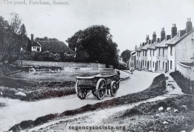
The Pond outside All Saints Church, Church Hill. Photo Circa 1900 from The Regency Society Collection
PATCHAM'S DRINKING WATER
The aquifer beneath the hill is a porous rock from which Southern Water extracts water. This water reaches the Waterhall Pumping Station through a series of adits (tunnels) which run deep underground to the bore hole in Mill Road. The adits link other aquifers in the system on the downs and water collected from all of these is then pumped from the Waterhall Pumping Station to our taps and to the homes of people in the wider city. In fact at times it provides water for up to 380,000 people as far out as Peacehaven!
This water comes directly to our taps from the aquifer system and it's natural purification system. The hills also provide the water pressure in our homes. The water quality is already a cause for concern with higher than recommended Nitrate levels and the development on Patcham Court Farm could further influence the water quality as it is in a downward quality trend.
In 2005 when the Park and Ride was being planned for the farm and allotments, a Southern Water spokesperson Paula Jackman confirmed that 17.5 million gallons of water were licenced to be pumped daily from Waterhall's groundwater supply. At times up to 46.5% of the daily requirements of every person in the city. Since then the city population has grown and with it the amount of water people require.
If the water in the hill becomes contaminated with pollution it can NOT be pumped from the hill to residents. In reverse the pumping station can not take water away back up into the hills if there is heavy rainwater and the groundwater rises! This leaves the village and surrounding areas at greater risk of flooding more regularly and with greater consequences.
THE HYDROGEOLOGY OF PATCHAM COURT FARM SITE
Back in 2005 when the council were investigating potential Park and Ride sites for the city, Patcham Court Farm was considered and assessed for a car park with a single storey on the North Side. The resulting report makes interesting reading about the hydrogeology of the site and describes the farmyard as being located over a major aquifer.
It was determined that the natural soils would be suitable founding strata for a lightly loaded structure associated with park and ride, but that excavation was thought at high risk of discovering the presence of solution features. These solution features are sink holes. One such sink hole was discovered on the West side of the farm by the roundabout when the ground was cut through for the bypass (see below).
There was intended to be a bridge across from the intended to be a bridge across from the farmyard to the farmland so the cattle could be taken onto the fields, but it was not possible to put one there due to instability and so this is why the farmyard fell into disuse. The existing footpath is in a different place further east.
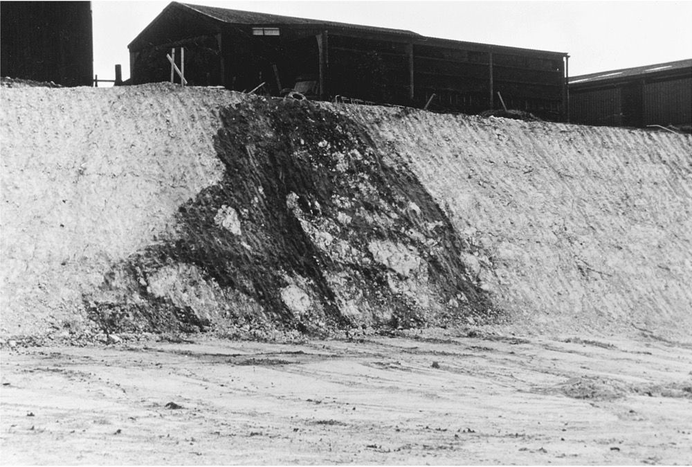
Collapsed cavern at Patcham Farm exposed in excavations for the A27 Bypass (GS 633) SOURCE
A HISTORY OF GROUNDWATER FLOODING
As many residents will know Patcham Village and the surrounding area of Patcham Place is liable to flooding. This is because the underground river, the Wellsbourne, begins at Patcham and runs down from the hills. The Wellsbourne is a winterbourne which once flowed seasonally down the valley, through Preston to the sea, before exiting through Poole Valley. After heavy rain significant flooding would occur but pumping water out of the Aquifer largely prevents the chaos such floods would cause.
In 2000 when the groundwater was very very high due to prolonged heavy rainfall, pumping at the station was not enough to stop it and tankers were bought in to pump the water out and take it away. This was because waste water was contaminating the drinking water supply and the water could not be pumped back into the hill. It was days before the water resided and much damage was done to the buildings in the conservation area and all along both sides of The Old London Road.
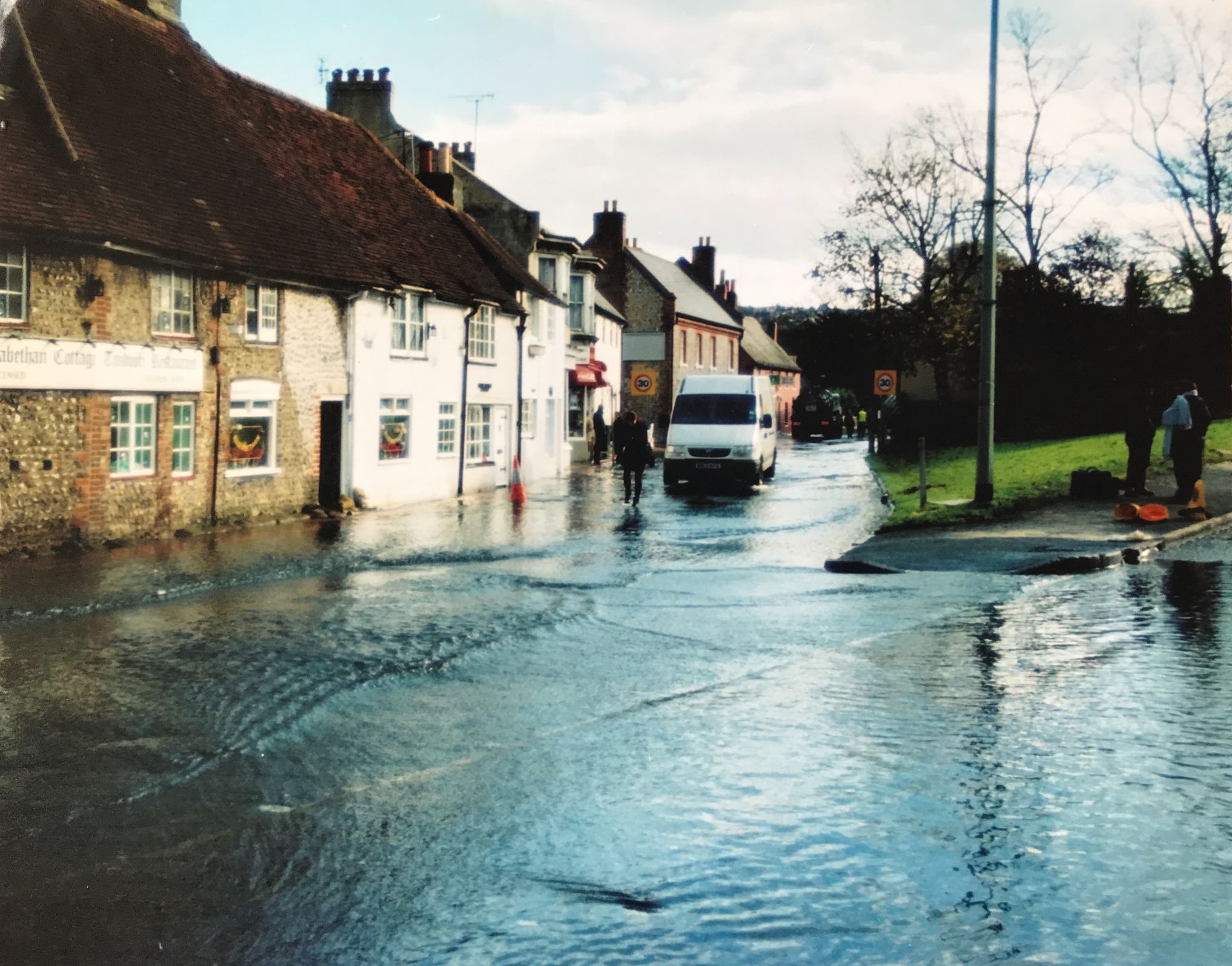
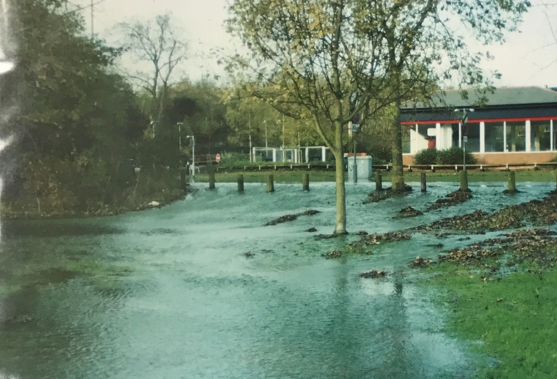
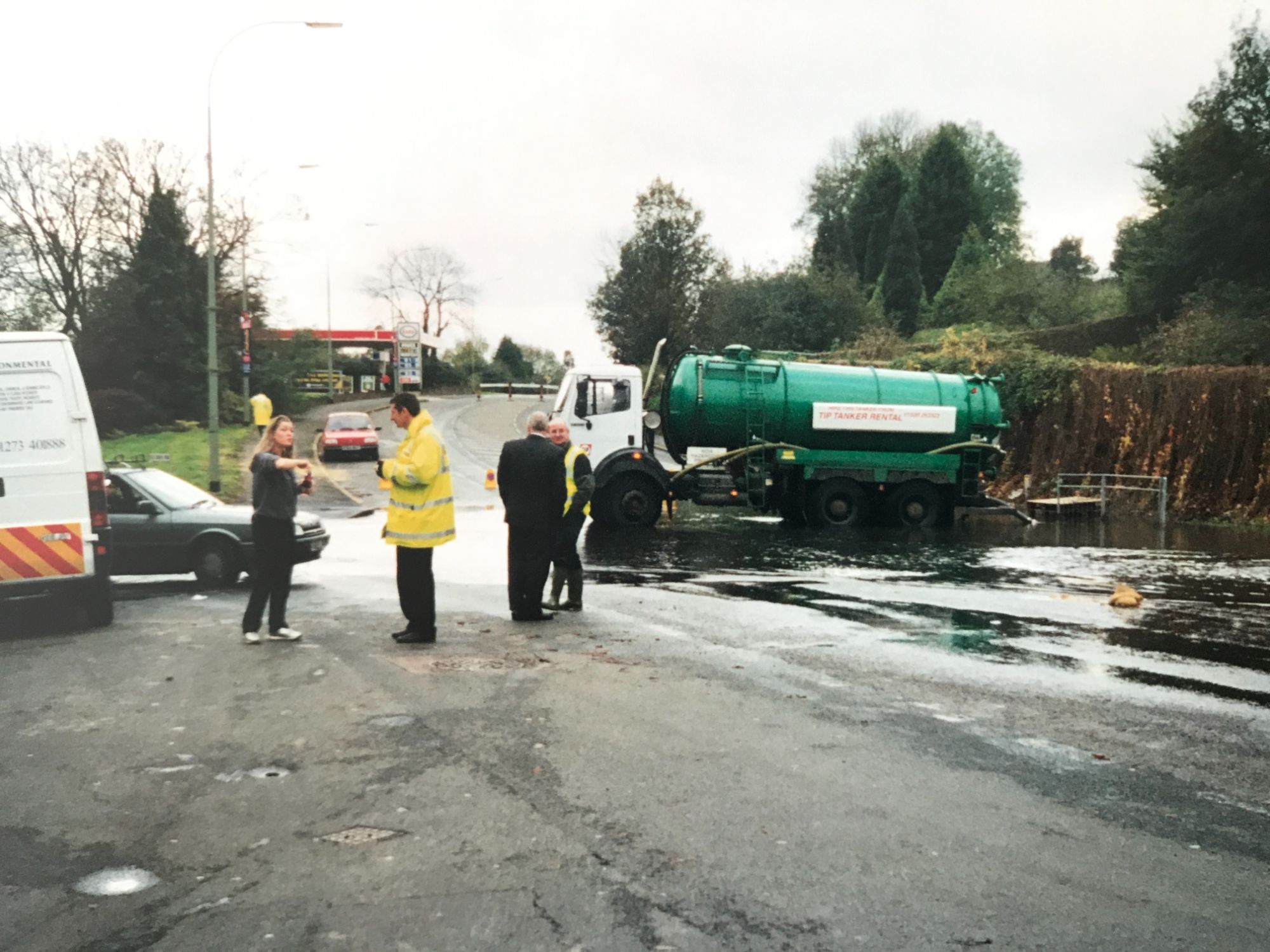
The Flooding of Patcham in November 2000
In recent years we have been dangerously close to the groundwater coming above the surface due to increases in heavy, large quantities of rainfall arriving at once.
2014 was the last time emergency community meetings were called and evacuation measures were discussed and readied.
Plenty of us will remember walking through the village with pumps across pavements at Spencer and Leigh, Wootten House and Patcham Place (to name a few) as they try to keep the water out of cellars. The water is not coming into their buildings it is rising up out of the ground and this is why it is difficult to mitigate.
Those who have been resident in Patcham for a long time will also remember the flooding in the 1960's when the water was around a foot deep. The occurrence of flooding is not a one off, nor a 1 in 100 year event that is represented by the documented 1% risk. Whilst it may not have the severity of these major instances groundwater can often be seen close to the surface and down our storm drains when rain levels are high. In 2020 severe flooding occurred in the railway tunnel for the commuter route between Brighton and London.
Extensive monitoring of the groundwater levels exists in the area and this can be viewed at any time.
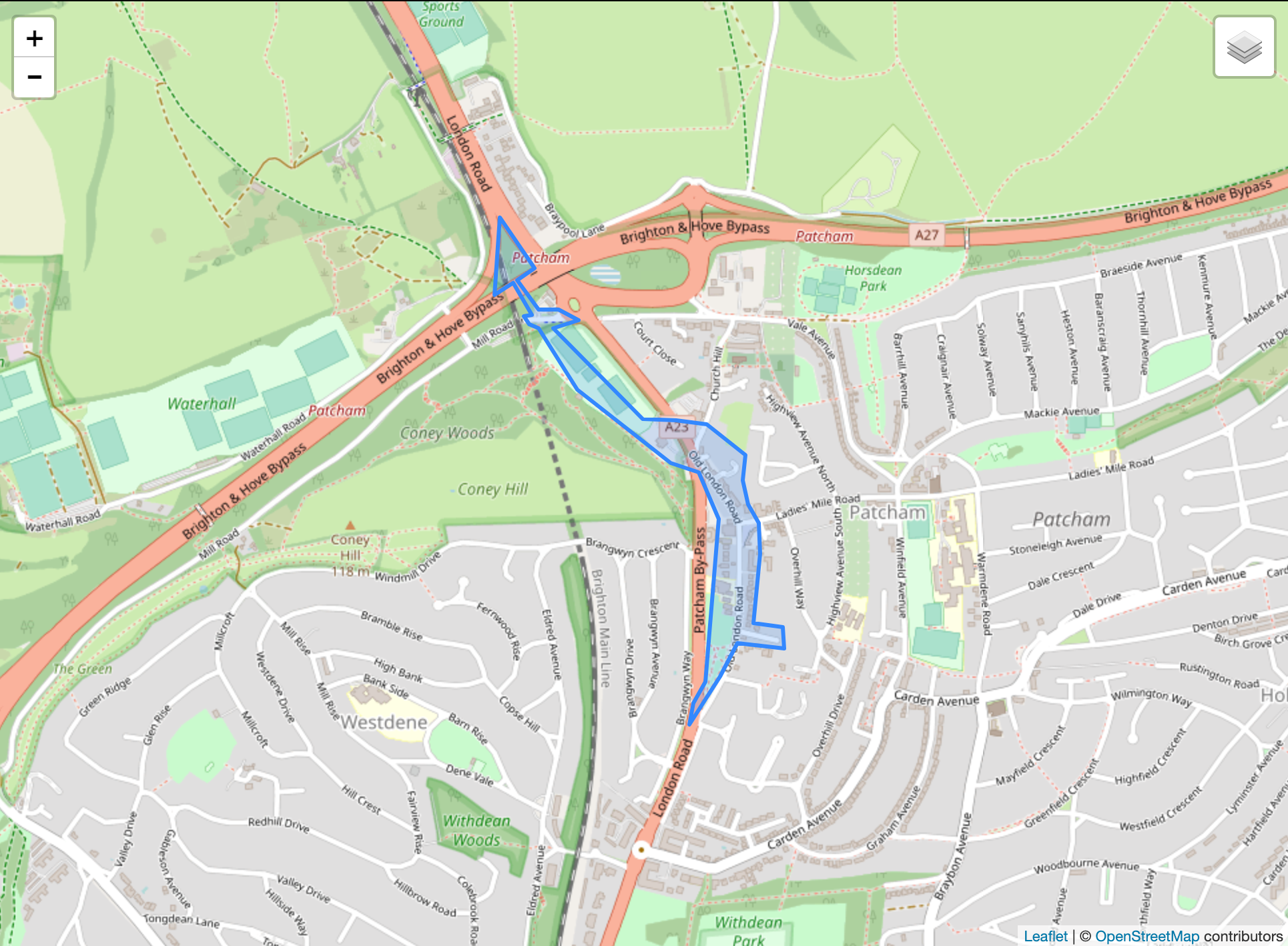
The area monitored for groundwater flooding in Patcham
Large floods are recorded in 2000, 1960, 1925, 1915/1916 and in 1875 (roughly every 40-50 years). In 1875 the pumping station was planned and built and it was expected this would be able to manage the flow of water to avoid catastrophic flooding. With the knowledge we have now it is clear that this is not the case and water will still find a way.
A stream of water 6ft wide in places flowed down the western side of the main (London) road this week. Villas between Withdean and Patcham which have cellars are affected by the surplus water. On Tuesday, water from the burst springs was flowing down the main London Road south of Patcham in greater volume than on the previous day and there was a continuous stream from a hundred yards south of Patcham School to within a like distance of the Preston boundary - a mile of water.”
As we move into a period of climatic change experts predict that our weather will change to long periods of drought and breaks of more heavy rainfall. This fundamentally increases the chances this will happen again and it has not been fully explored within the planning application how the development could impact the natural water systems.
